About the Lake
Lake Information
Area: 113.93 acres
Littoral Area: 109 acres
Shore Length: 4.1 miles
Mean Depth: N/A
Maximum Depth: 19 feet
Average Water Clarity: 9.0 feet
Access: City-owned public access within Eden Prairie’s Miller park
Motor restriction: 10 hp max
Other resources:
Mitchell Lake Info Page on RPBC Watershed District Website
Mitchell Lake DNR Lake Report, including; Lake quality, fish stocking, maps & more
Minnesota DNR Shoreland Management
Lake Monitoring
What gets Monitored?
Did you know that the health of our lake is being monitored by the Riley Purgatory Bluff Creek Watershed District (RPBCWD), the DNR, the City of Eden Prairie, and also by some of your neighbors? Here’s a partial list of who is doing what:
- Lake Level: RPBCWD puts out a sensor out every summer to track lake level which is shared with the DNR and posted on the DNR Lake Finder Site.
- Aquatic plants: RPBCWD hired the University of Minnesota to do surveys over the past several years. These surveys help us know whether RPBCWD needs to manage invasive species.
- Invasive mussels: RPBCWD collects water samples to look for the juvenile life-stage of invasive mussels. None have been detected yet.
- Water quality: The City of Eden Prairie collects samples during the summer months and shares data with RPBCWD and the MPCA
Volunteer Monitoring
- Metropolitan Council (MCES): Citizen-Assisted Monitoring Program (CAMP) – Volunteers collect surface water samples for laboratory analysis of phosphorus, nitrogen, and chlorophyll-a. They also obtain temperature, Secchi transparency measurements. Results posted on Metropolitan Council website
- Minnesota Pollution Control Agency (MPCA): Citizen Monitoring Program – Volunteers collect water clarity data as measured with a Secchi disk. Data is posted on MPCA website.
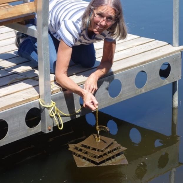
- RPBCWD: Volunteers hang monitoring plates from the end of their docks and check them twice a month for the presence of invasive Zebra mussels. Good news… no Zebra mussels found to date!
Ice Out Dates
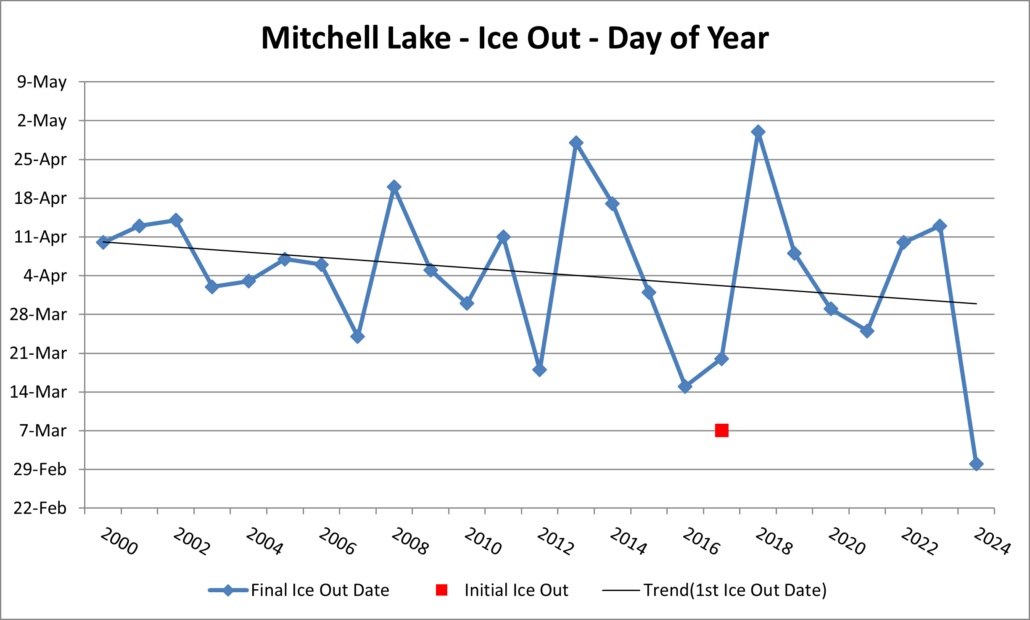
2024 Ice out on March 1
Sources:
2000-12: Ice out dates were recorded by the Nelson’s of Weston Bay before they moved from the neighborhood.
2013-15: Ice out dates were recorded by John Tyler
2016-Current: Ice out date recorded by Cheri Nehl and Zach Fetzer.
- Ice out definition used: Able to navigate from the inlet at Highway 5 to the Miller Park boat launch.
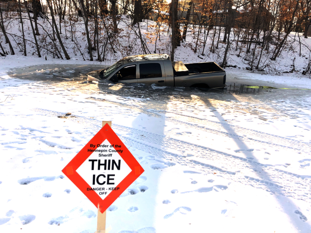
Beware of Thin Ice
Please use caution on ice!
Ice thickness can vary across an area, make sure you check more than one spot. DNR ice thickness recommendations are:
- 4 inches for walking
- 5 inches for a snowmobile or ATV
- 8-12 inches for a car
- 12-15 inches for a med size truck


